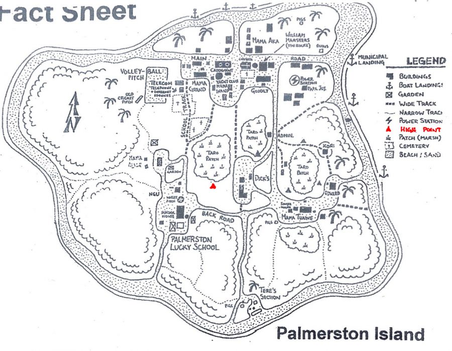
Maximale Erhebung: Refuge Hill (6 m), „High Point” bzw. „The Mountain” (4 m)[1] nahe der Klinik in der Mitte der Insel auf dem Palmerston Atoll bzw. der Palmerston-Insel[2]
[1] Geography, Palmerston Island 2013-09-15, http://www.palmerstonisland.net/index.php?option=com_content&view=article&id=463:geography&catid=75&Itemid=411 (aufgerufen am 2015-05-24) und Did You Know, Nothing Goes Wrong on Palmerston Island, Sometimes Interesting 2014-10-19, http://sometimes-interesting.com/2014/10/19/nothing-goes-wrong-on-palmerston-island/ (aufgerufen am 2015-05-19) und Our Social Studies Trip – Life in Palmerston, a long time ago, Palmerston pupils take trip into past, Entertainment, Cook Islands News September 2015-09-15, https://www.cookislandsnews.com/entertainment/palmerston-pupils-take-trip-into-past/ (aufgerufen am 2021-06-01)
[2] MARSTERS, Bill Tuakana; Angestellter von Palmerston Radio, persönliche Kommunikation (E-Mail erhalten am 2015-06-02, s. Quellenverzeichnis der persönlichen Kommunikation)
Neueste Kommentare